The dominant of Ještěd Ridge is the rotating hyperboloid from architect Hubáček. The climb is hard, fortunately except for the prospect of Ralsko
and Jizera Mountains we will meet several pleasant pubs. We will visit another work of modern architecture - Transbordér pod Hamrštejnem
by Martin Rajniš. And finally, take a ride with two cableways and try one of the downhills Ještěd bikepark.
Route:
From Hodkovice nad Mohelkou via Záskalí climb to the top of Javorník on red - blue to Javorník chapel - downhill on meadow
to Rašov saddle - blue to refreshment U Šámalů - alongn the cycle path 3007 and blue to Plač pod Ještědem -
down the red trail to Ještěd - exit from the top along the road to the Ještědka car park - follow the green trail to the Výpřež saddle -
Follow the red trail to the Trávník crossroad - follow the green over crossroads to the Beech of Republic crossroad - follow the unmarked road to the Andělská hora -
Follow the blue trail to Transborder - follow the yellow trail along the railway line and cross the railway bridge clese to Machnín railway station -
along the green to Hamrštejn - unmarked roads to the railway station Karlov pod Ještědem - yellow to Srní sedlo -
on an unmarked forest path and on a nature trail Playful wandering through the Ještěd forest to Výpřež saddle - yellow to Pláně pod Ještědem -
Follow yellow and green to U Šámalů refreshment - follow blue to Záskalí - follow red to Hodkovice nad Mohelkou
 The dominant of Ještěd Ridge is the rotating hyperboloid from architect Hubáček. The climb is hard, fortunately except for the prospect of Ralsko
and Jizera Mountains we will meet several pleasant pubs. We will visit another work of modern architecture - Transbordér pod Hamrštejnem
by Martin Rajniš. And finally, take a ride with two cableways and try one of the downhills Ještěd bikepark.
The dominant of Ještěd Ridge is the rotating hyperboloid from architect Hubáček. The climb is hard, fortunately except for the prospect of Ralsko
and Jizera Mountains we will meet several pleasant pubs. We will visit another work of modern architecture - Transbordér pod Hamrštejnem
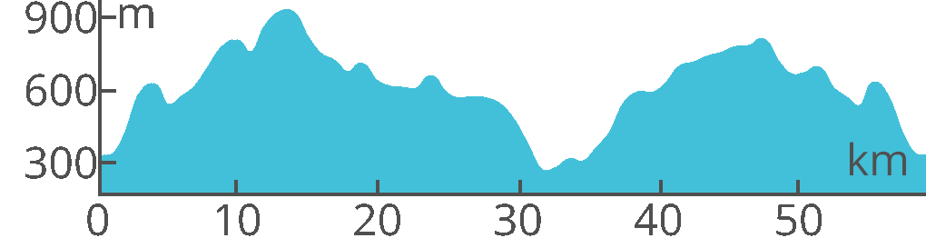
by Martin Rajniš. And finally, take a ride with two cableways and try one of the downhills Ještěd bikepark.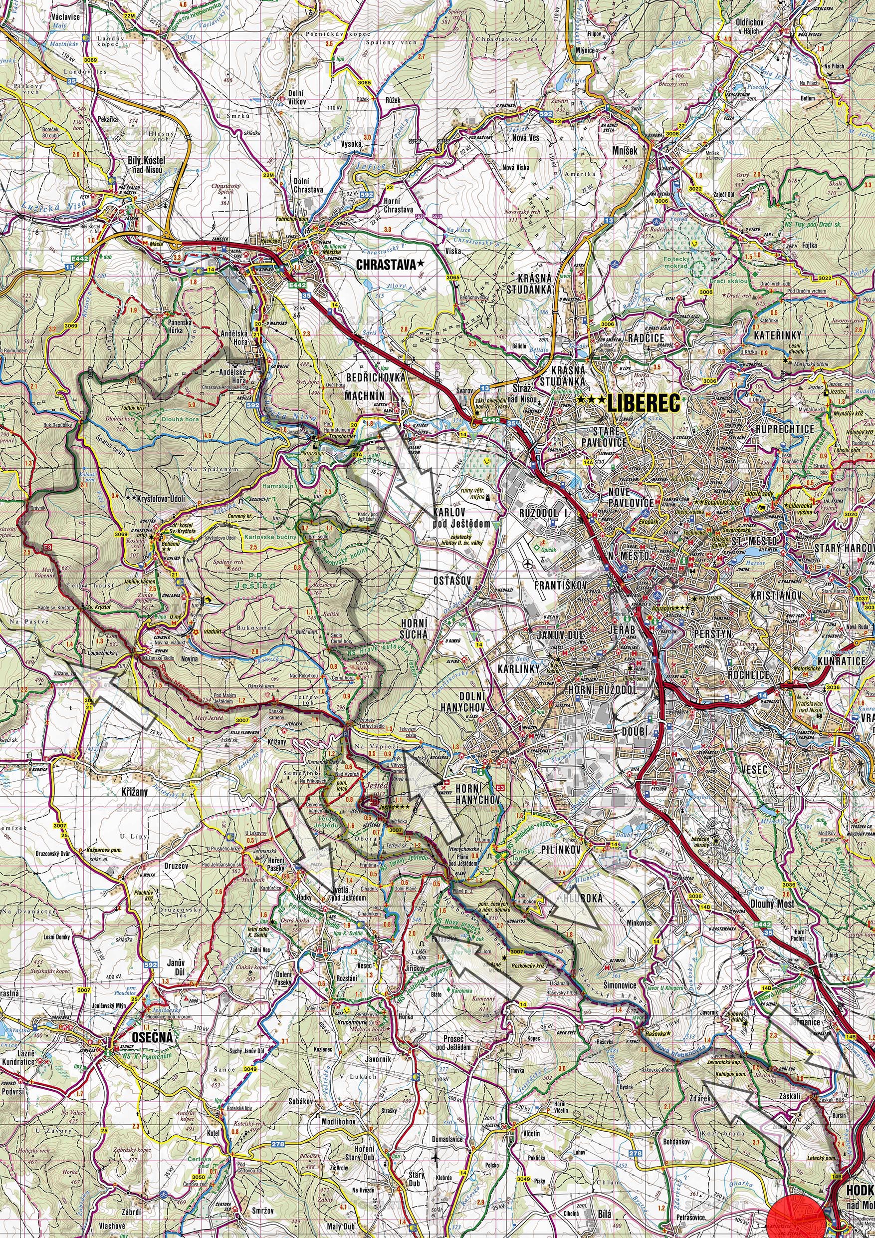 Lenght: 59 km